Monterey MemoriesConnect

  • Home
  • Visitor Info
    • Area Maps
    • Attractions
    • Calendar of Events
    • Hotels & Inns
    • Photos & Videos
    • The DVD
  • Shopping
    • Online Store
    • Carmel Shops
  • Homes & Real Estate
  • Food & Wine
    • Restaurants & Bars
    • Wineries & Tastings
  • Nightlife
  • Locals Corner
    • Dating
    • Events Calendar
  • Funny Weekly
  • Google

Monterey County Maps

Picture
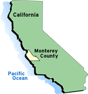
Monterey County, located on California's central coast, is about two hours south of San Francisco and four hours north of Los Angeles.

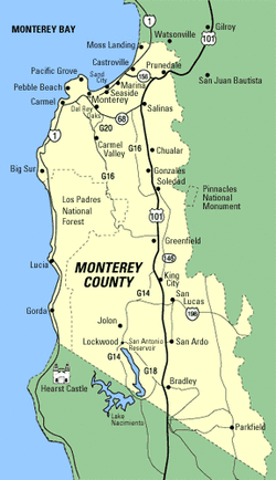
California Highway 101 bisects the county providing easy access to all Salinas Valley cities and the Monterey Peninsula. Highway 1 offers a scenic view of the California coast. For more details on how to drive to Monterey County, see our Driving Directions page.

View and Download Monterey County Maps

Click here for a detailed map that includes all of Monterey County. Click on the links below for high-resolution maps of Monterey County communities, suitable for printing.

  • Monterey
  • Carmel and Carmel Valley
  • Pacific Grove
  • Pebble Beach
  • Salinas
  • Seaside, Marina, Sand City and Moss Landing
Picture

Powered by Create your own unique website with customizable templates.